Our favourite places to swim around Wānaka, Hāwea and Dunstan. Often there is a group doing one of these, so check the Facebook group. Wear a bright cap and pull a tow float, and read the safety notes before heading further afield.
Tap a number, or any swim below, to see its route, photo and notes.
The three swims we do most and love to share, all starting from Roys Bay.
From the Watersports Facility swim straight out to the large white buoy and turn right towards town.
See the swim →From the Watersports Facility swim out to the large white buoy and turn left, away from town.
See the swim →Start from the bottom of Waterfall Creek Road.
See the swim →Walk about 200 m along the Millennium Track from the bottom of Waterfall Creek Road, to the small beach just before the track climbs.
See the swim →Follow the lakeside track or drive Lakeside Road to the Coastguard building at the high point, turn left, and about 100 m on take the sharp hidden…
See the swim →Drive to the end of Beacon Point Road and turn left down the steep hill to the beach.
See the swim →At the entrance to Dublin Bay and the outlet.
See the swim →From The Outlet camp go down to the beach.
See the swim →Very busy over Christmas with lots of other lake users, so keep your eyes open.
See the swim →A cold glacial lake on top of Mou Waho Island: a lake on an island in a lake, which itself has an island.
See the swim →South-east corner of the bottom of Lake Hāwea.
See the swim →Turn-off near the middle of Hāwea township.
See the swim →One of the jewels of Lake Hāwea, but the lake can come up rough quickly.
See the swim →Through Cromwell towards Bannockburn, then left over the Kawarau River.
See the swim →From the river bank by the Albert Town bridge and campground.
See the swim →Through Clyde, cross the river, then turn left towards the Clyde Rowing Club near the end of the road.
See the swim →Inflatable obstacle park with the occasional unintentional swim.
See the swim →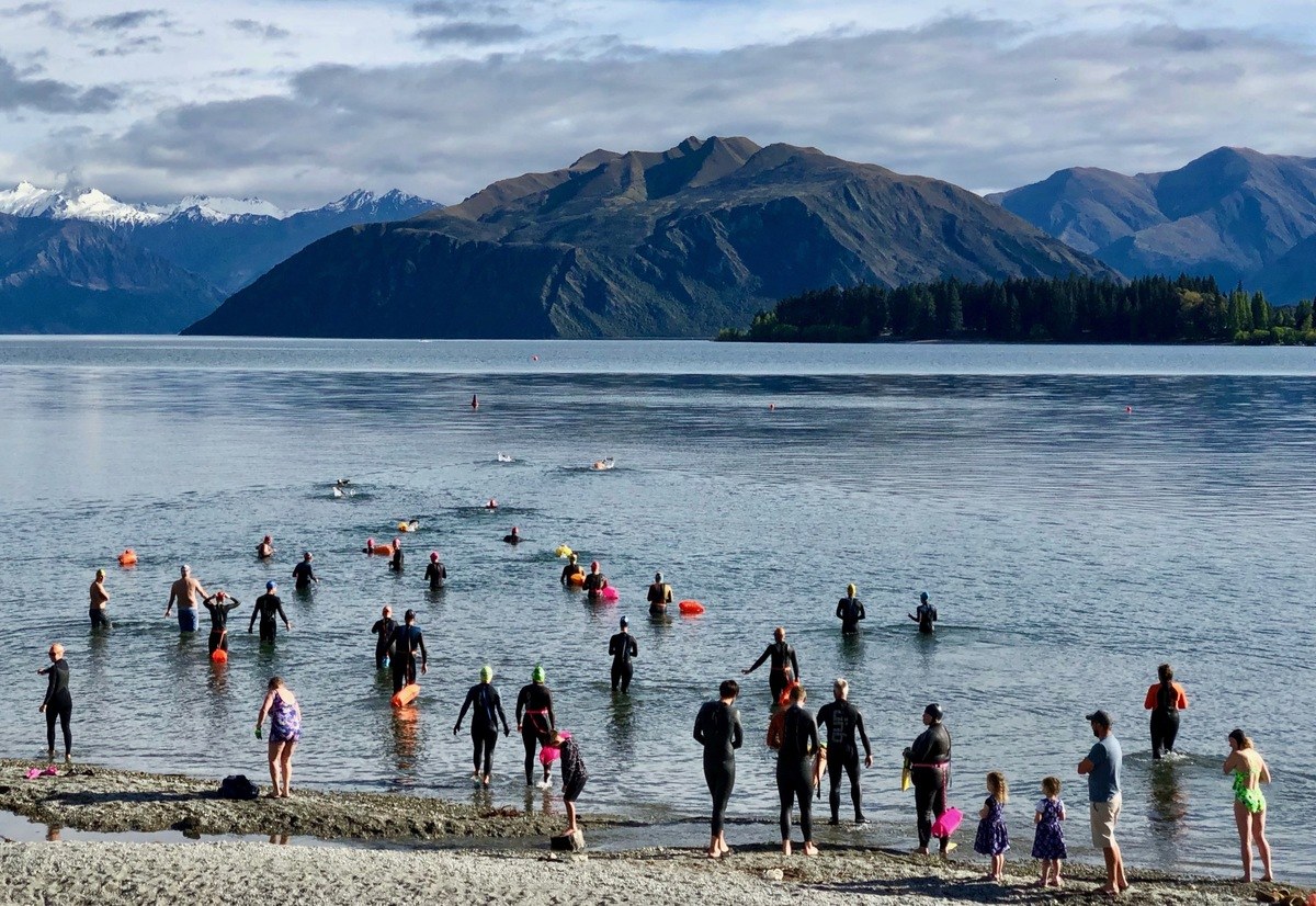
Red line: the usual route. Solid going out, dashed coming back. A guide, not a measured course.
From the Watersports Facility swim straight out to the large white buoy and turn right towards town. Three large white buoys with small orange ones between them, 500 m out and 500 m back. Keep them on your left, turn at the end buoy and come back with the orange buoys still on your left. You can also start from the car park by the toilet block at the town end.
Swim with others, wear a bright cap and tow float, and read the safety notes.
Red line: the usual route. Solid going out, dashed coming back. A guide, not a measured course.
From the Watersports Facility swim out to the large white buoy and turn left, away from town. Follow the three yellow 5-knot buoys on their shore side. The third is about 600 m out. The Rock is off the point about 1 km from the start. At high lake levels it is under water with a small orange buoy nearby; at low levels it is exposed with other rocks below the surface. Morning sun-strike can make sighting hard on the way back, so aim for the Facility.
Map position approximate
Swim with others, wear a bright cap and tow float, and read the safety notes.
Red line: the usual route. Solid going out, dashed coming back. A guide, not a measured course.
Walk about 200 m along the Millennium Track from the bottom of Waterfall Creek Road, to the small beach just before the track climbs. Swim away from town along the shelf 10 to 20 m offshore where the lake drops steeply, keeping the bottom in sight. There is no easy walking access, so remember you have to swim back. Regular swim here at 8:45am every Friday, all year. Everyone welcome.
Swim with others, wear a bright cap and tow float, and read the safety notes.
Red line: the usual route. Solid going out, dashed coming back. A guide, not a measured course.
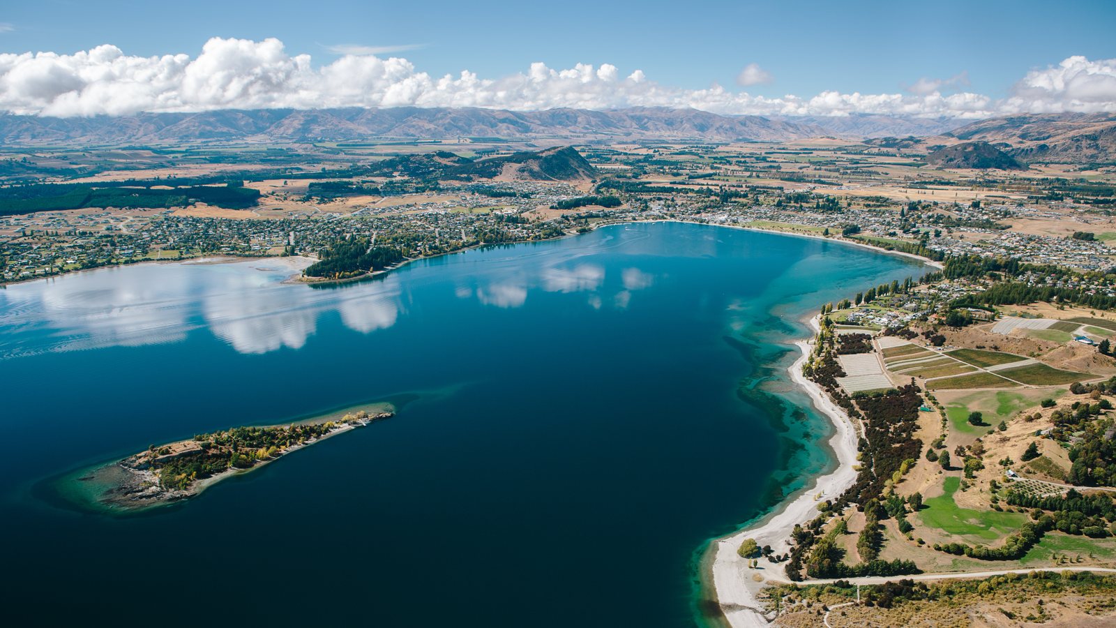
Start from the bottom of Waterfall Creek Road. The crossing is deep, so you will not see the bottom; make sure your group is comfortable with that. It is about 600 m to the wharf at the south-east of the island, then a lap of the island keeping the bottom in sight, then back. Busy with boats in peak season: swim in a group with a kayak or SUP alongside.
Swim with others, wear a bright cap and tow float, and read the safety notes.
Red line: the usual route. Solid going out, dashed coming back. A guide, not a measured course.
Follow the lakeside track or drive Lakeside Road to the Coastguard building at the high point, turn left, and about 100 m on take the sharp hidden left down to the beach. Barbecues, benches and a nice wee beach, busy in the summer holidays. North are ski lanes and powerboat access, so swim south around the outside of the moored boats, and check they are not moving.
Swim with others, wear a bright cap and tow float, and read the safety notes.
Red line: the usual route. Solid going out, dashed coming back. A guide, not a measured course.
Drive to the end of Beacon Point Road and turn left down the steep hill to the beach. Just north of where you start (watch the rocks) a shelf runs out into the lake. Follow it out to the beacon at the end; at normal lake levels you can stand there. A bit weedy close to shore.
Swim with others, wear a bright cap and tow float, and read the safety notes.
Red line: the usual route. Solid going out, dashed coming back. A guide, not a measured course.
At the entrance to Dublin Bay and the outlet. Open water with boats that can be moving fast, so take care. Go along Beacon Point Road onto Penrith Park Drive, park at the end and walk down to the point. Note where you started before you go, as the return point can be hard to sight.
Swim with others, wear a bright cap and tow float, and read the safety notes.
Red line: the usual route. Solid going out, dashed coming back. A guide, not a measured course.
From The Outlet camp go down to the beach. This is the start of the Clutha River, so there is a current. Swim up into it near the shore where it is weaker, then return. Take care crossing. People swim or float down the river, but there are rapids with big rocks you can be pulled towards. Never do it alone.
Swim with others, wear a bright cap and tow float, and read the safety notes.
Red line: the usual route. Solid going out, dashed coming back. A guide, not a measured course.
Very busy over Christmas with lots of other lake users, so keep your eyes open. Swim from where the road meets the lake at the Mt Aspiring lookout. The large dark buoys mark matting laid on the lake bed to control invasive weed. For somewhere quieter, walk the Millennium Track back towards Wānaka (watch for bikes). Rotary Park, just past the camp, is another popular spot.
Swim with others, wear a bright cap and tow float, and read the safety notes.
Red line: the usual route. Solid going out, dashed coming back. A guide, not a measured course.
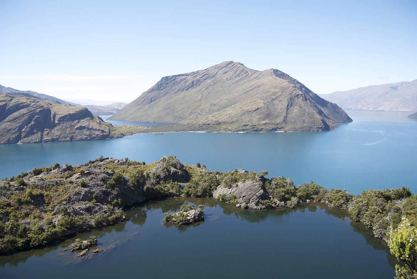
A cold glacial lake on top of Mou Waho Island: a lake on an island in a lake, which itself has an island. You need a boat to get there; try Wanaka Water Taxi (Krystal is a swimmer). Mou Waho is a predator-free sanctuary for weka, tūī and kererū. The pool is small, so not a demanding swim, but something you must do if you get the chance.
Swim with others, wear a bright cap and tow float, and read the safety notes.
Red line: the usual route. Solid going out, dashed coming back. A guide, not a measured course.
South-east corner of the bottom of Lake Hāwea. Take Timaru Creek Road and watch for the turn-off. Swim up the east side as far as you like, remembering you have to swim back unless someone picks you up. You can also cross the bottom of the lake, but watch for boats, especially water skiing.
Swim with others, wear a bright cap and tow float, and read the safety notes.
Red line: the usual route. Solid going out, dashed coming back. A guide, not a measured course.
Turn-off near the middle of Hāwea township. Swim along the lakeside either way and watch for other lake users. There is a small island, or large rock, you can swim to across the lake outlet.
Swim with others, wear a bright cap and tow float, and read the safety notes.
Red line: the usual route. Solid going out, dashed coming back. A guide, not a measured course.
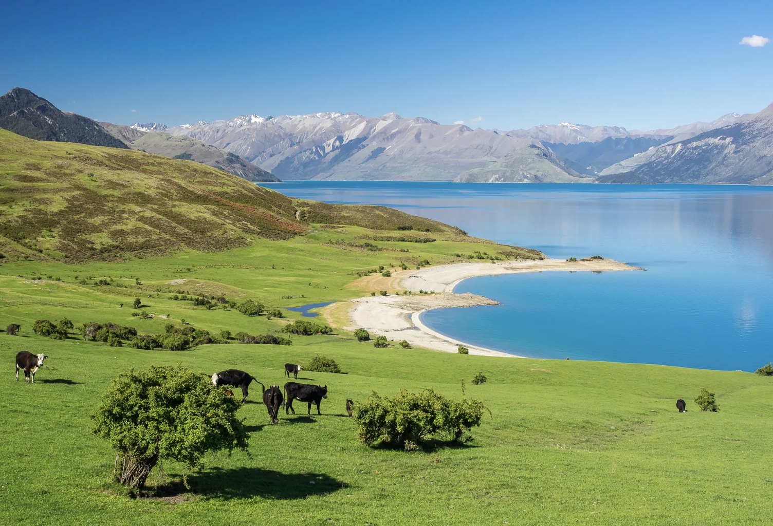
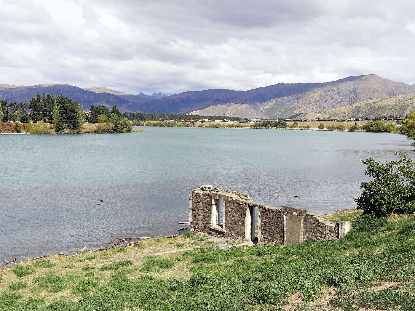
One of the jewels of Lake Hāwea, but the lake can come up rough quickly. Drive north on SH6 to just before the Isthmus Peak car park; the small Bottom Bay sign near the top of a rise is easy to miss, with parking for a couple of cars. The walk down is steep and grassy, so wear good shoes. Swim north and in under 1 km you are above the forest drowned when the lake was raised 20 m in 1958.
Swim with others, wear a bright cap and tow float, and read the safety notes.
Red line: the usual route. Solid going out, dashed coming back. A guide, not a measured course.
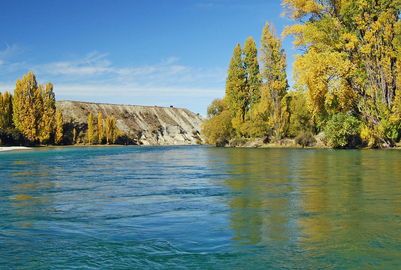
Through Cromwell towards Bannockburn, then left over the Kawarau River. Over the small hill are lots of safe swimming spots. More of a family swimming area.
Swim with others, wear a bright cap and tow float, and read the safety notes.
Red line: the usual route. Solid going out, dashed coming back. A guide, not a measured course.
From the river bank by the Albert Town bridge and campground. A major river with a strong current. Keep to the edge and watch for other users. You can swim down the river, but never alone, and have transport waiting at your exit.
Swim with others, wear a bright cap and tow float, and read the safety notes.
Red line: the usual route. Solid going out, dashed coming back. A guide, not a measured course.
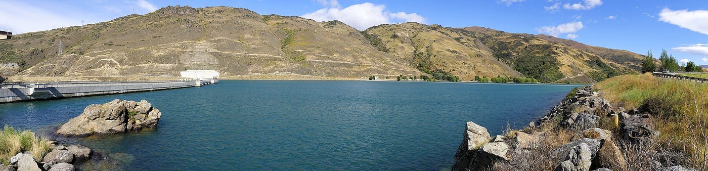
Through Clyde, cross the river, then turn left towards the Clyde Rowing Club near the end of the road. Nice picnic area. Follow the boom line across the dam face to the other side and back. Watch for rowers, who are going backwards and may not see you.
Swim with others, wear a bright cap and tow float, and read the safety notes.
Red line: the usual route. Solid going out, dashed coming back. A guide, not a measured course.
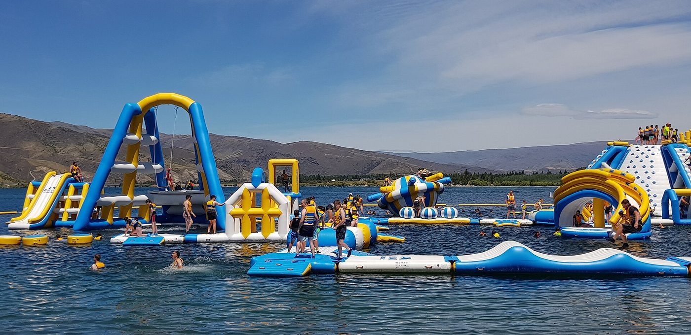
Inflatable obstacle park with the occasional unintentional swim. Popular in the holidays, bookings essential, and there is a cost.
Swim with others, wear a bright cap and tow float, and read the safety notes.